VISTA: Vegetation Informed Sensing Through Active Mapping

Department of Computer Science and Engineering
Center for Embodied Autonomy and Robotics (CEAR)
University at Buffalo

A small drone has only minutes of useful flight time, and a field seldom changes in ways that are easy to catch. Water stress, mowing, exposed soil, slope, and shifting light leave marks that an evenly spaced survey grid tends to miss or misread. VISTA asks how to spend that flight time well: measuring the parts of a field where vegetation condition is actually changing, and flagging the places where the data are too uncertain to draw conclusions from.

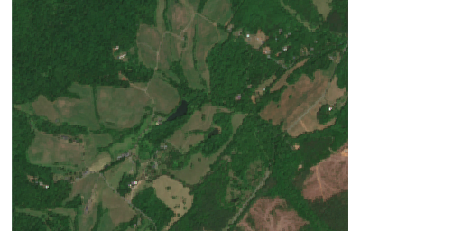
RGB field imagery example
RGB
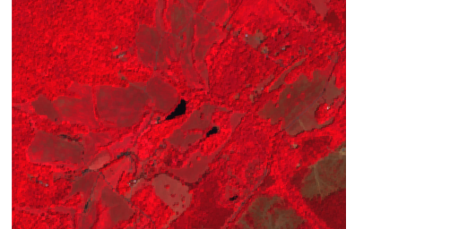
Multispectral field imagery example
Multispectral
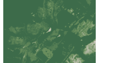
NDVI vegetation index example
NDVI

Abstract

VISTA (Vegetation Informed Sensing Through Active Mapping) is an ongoing project on aerial vegetation sensing under field constraints. Small uncrewed aircraft can survey vegetation at useful spatial scales, but each flight is limited by battery, light, terrain, and calibration overhead, and not every part of a field carries the same information. We study how a UAV should allocate its limited sensing budget when full, uniform coverage is slow, expensive, or unnecessary for the question at hand.

The project draws on aerial robotics, remote sensing, and agricultural field study to assess vegetation condition from fewer, better-placed measurements. We are less interested in producing another map than in making the data behind it defensible: responsive to real variation on the ground and explicit about what it cannot resolve. Code, data, and papers will be released after publication.


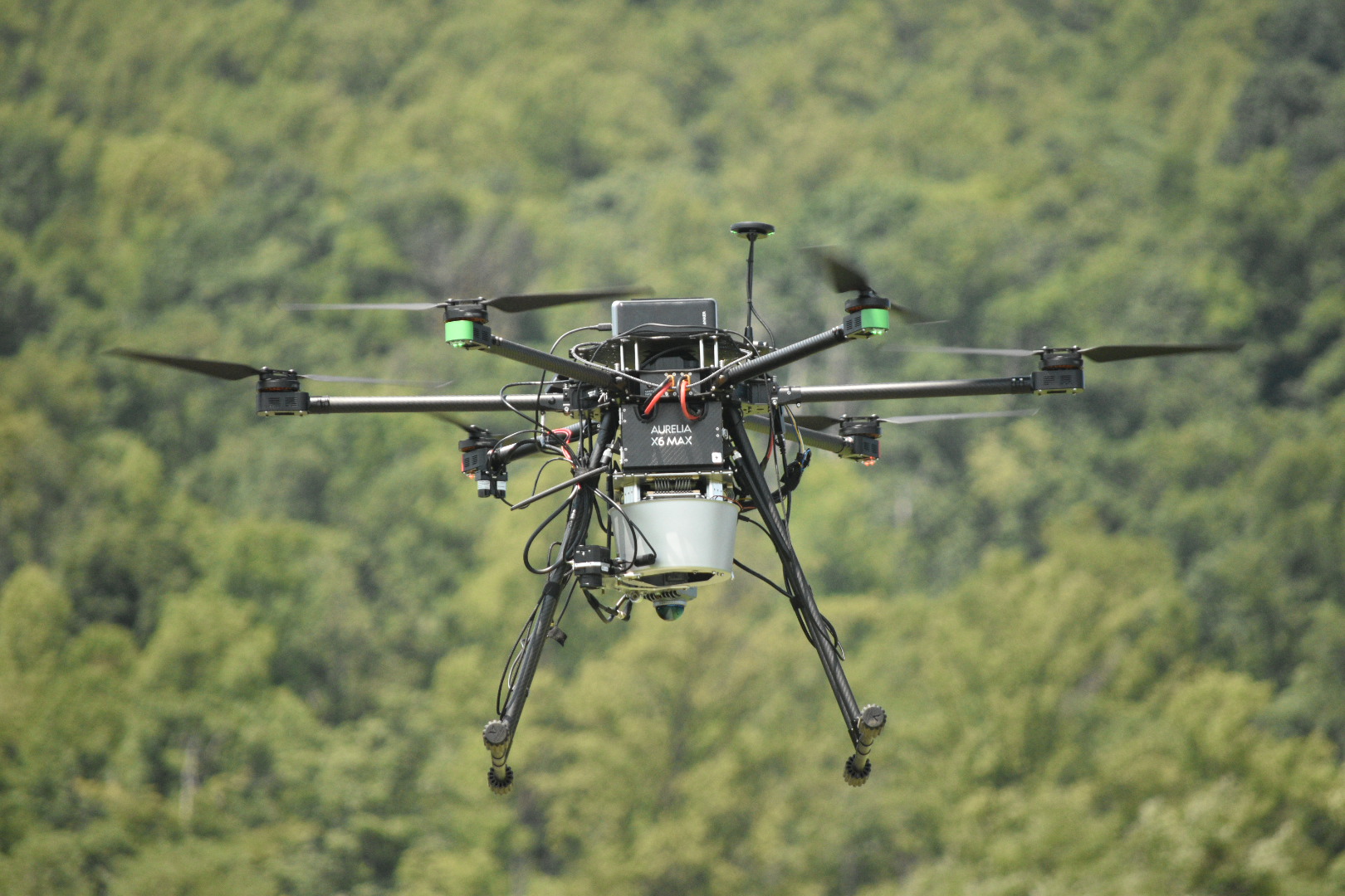
VISTA hexarotor flying over the field with thermal, hyperspectral, and LiDAR sensors
The VISTA hexarotor in flight, carrying thermal, hyperspectral, and LiDAR sensors for synchronized field observations.

In the News

WVTF / Radio IQ

Research could revolutionize farming

WVTF visits the field team at UVA's Morven Farm, where researchers from NASA, UVA, and the University at Buffalo are testing drone-based sensing to catch crop stress earlier and support more precise farming.

Read the article

Research Focus

The core question is one of triage: when a survey cannot measure everything, what should it measure? In vegetation monitoring the answer is rarely obvious, because small differences in cover, moisture, terrain, and illumination can change what an observation means. A bright green patch might signal vigor, delayed senescence, or just a favorable sun angle; a bare patch might be stress, past management, or exposed soil. Deciding where to look is itself part of the measurement.

This matters because field data are costly to collect and easy to over-interpret. We concentrate on three problems that recur across agriculture and ecology: mapping vegetation that is patchy rather than uniform, separating terrain effects from genuine changes in canopy condition, and accounting for how the signal drifts as the sun moves through the day. The aim is a survey whose output answers the question actually being asked, and is honest about where it cannot.

System Architecture

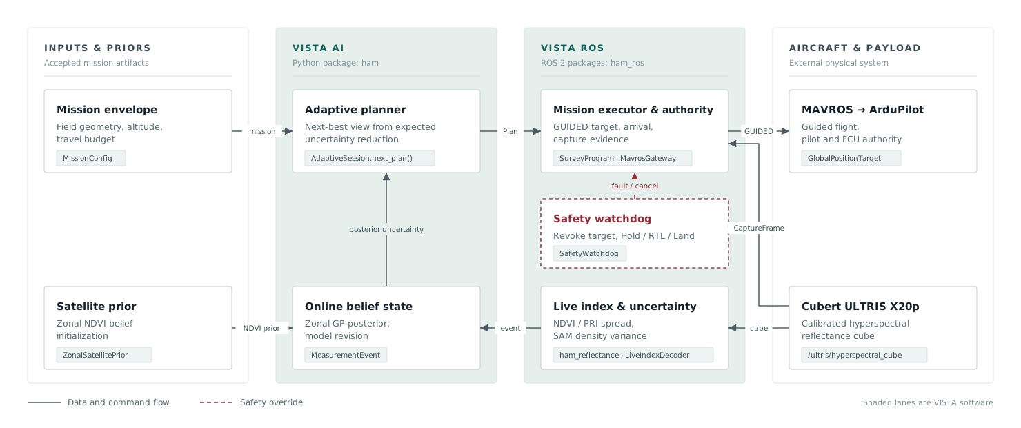
VISTA system architecture: mission inputs and satellite priors feed the AI planner, which sends flight plans to the ROS executor and aircraft. Hyperspectral measurements flow back to improve the next decision, while an independent safety watchdog can override the mission.

VISTA turns each flight into a continuous learning loop. Satellite data gives the system a starting point, the planner chooses where the drone should look next, and new hyperspectral measurements improve the next decision. A separate safety watchdog can pause or end the mission at any time.

Field Study

The work is grounded in outdoor flights over working fields, not staged laboratory scenes. We are measuring how aerial observations behave across mixed vegetation, uneven terrain, and changing light, and where the tidy assumptions of a controlled study break down once you leave it. Flights include repeated passes and control plots, so that a pattern that looks biological can be checked against the conditions under which it was recorded.

The intent is practical: to give field scientists timely measurements without forcing every survey into an exhaustive scan. What we are after is aerial sensing that documents vegetation change and reports it with the necessary caveats. It should say where a field has changed and, just as clearly, how sure we are that it has.

BibTeX

@inproceedings{vista2026,
  title     = {VISTA: Vegetation Informed Sensing Through Active Mapping},
  author    = {Charuvahan Adhivarahan and Jagadeswara PKV Pothuri and Karthik Dantu},
  booktitle = {TBD},
  year      = {2026},
  url       = {}
}