HOPHY: A Hypergraph-Based Hierarchical Terrain Representation for Off-Road Path and Mission Planning


University at Buffalo
HOPHY terrain hierarchy and query pipeline

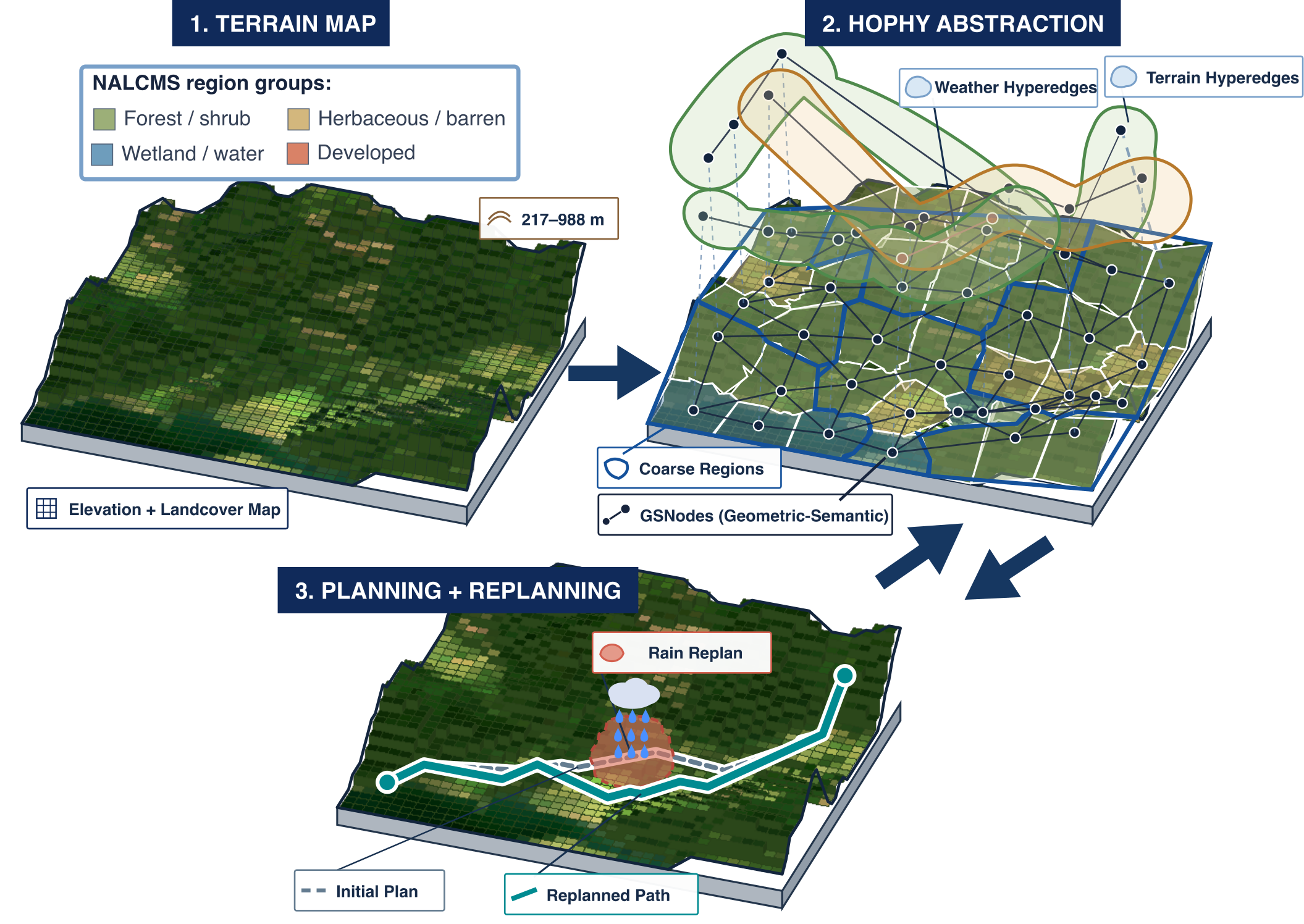
HOPHY turns map-scale terrain into a reusable planning state. Geometric-semantic nodes, coarse regions, and typed hyperedges support fast repeated path queries, localized context updates, and mission planning for heterogeneous robot teams.
Abstract

Mission-level autonomy for disaster response, search and rescue, and tactical ground vehicles requires repeated path and mission planning as terrain conditions, agent types, and objectives change. Pixel-grid planners are accurate but too slow for repeated queries at kilometer scale, while existing semantic abstractions are fast but costly to update. HOPHY (Hierarchical Off-Road Planning using Hypergraphs) organizes terrain into geometric-semantic nodes, connectivity-preserving coarse regions, and typed hyperedges for terrain, agent, and weather context. Hyperedges modify only affected nodes and incident edges, avoiding full-graph recomputation. Across kilometer-scale benchmarks, HOPHY preserves path quality close to pixel A* while enabling repeated planning, localized replanning, multi-agent task allocation, and physical-robot deployment.

HOPHY Framework

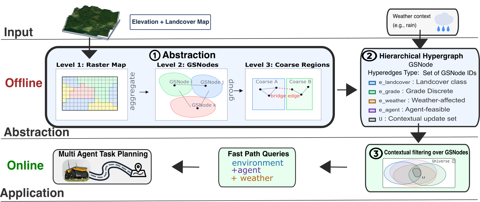
HOPHY hierarchical hypergraph framework

Hierarchical Hypergraph Planning

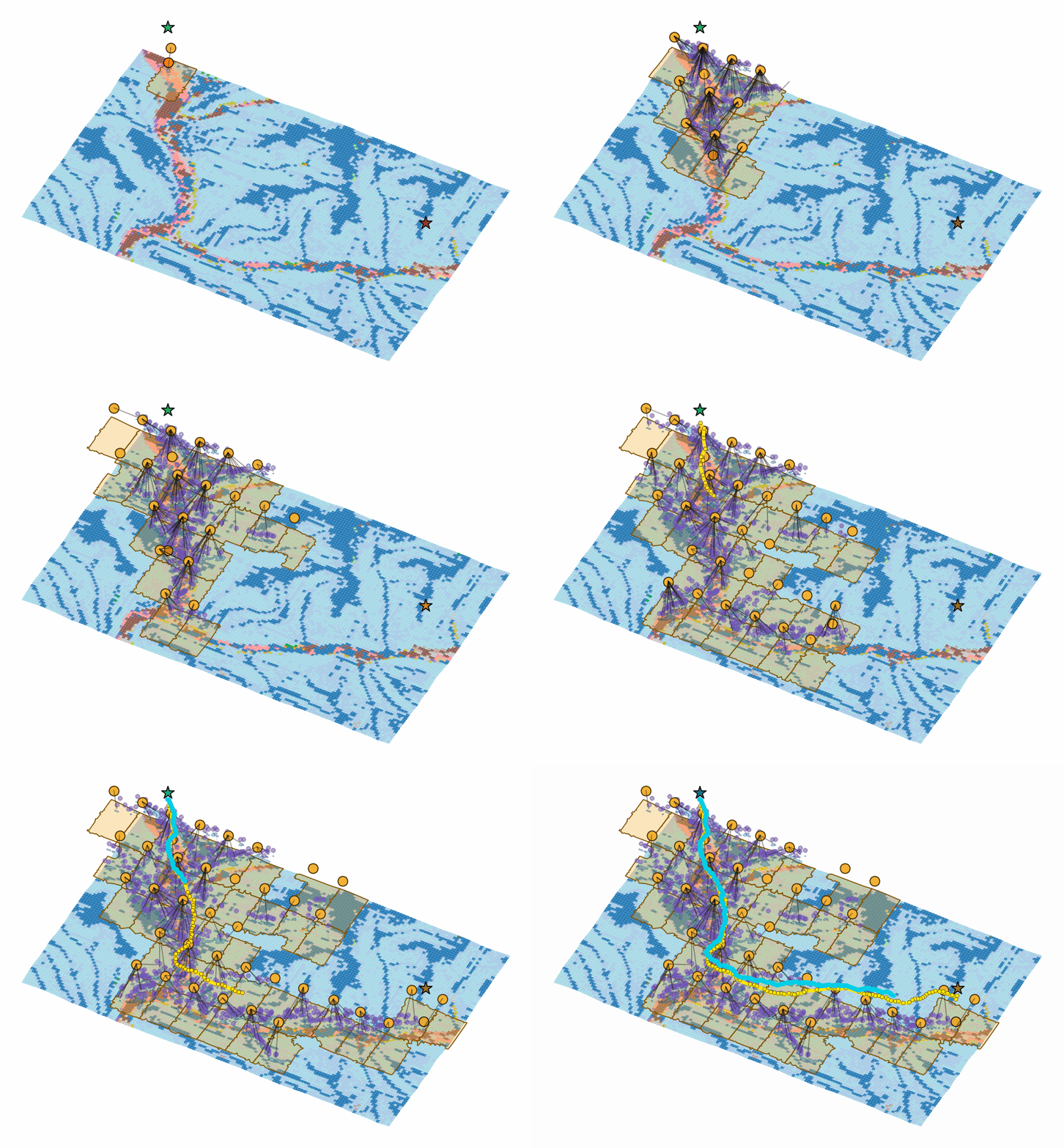
HOPHY groups connected terrain with consistent landcover and grade into GSNodes, then aggregates them into coarse regions that bound long-range search. Typed hyperedges index overlapping contextual memberships—such as terrain class, weather response, or agent feasibility—so a change can be applied to the relevant terrain subset without rebuilding the full representation. Each query searches from coarse regions to GSNodes and refines the selected corridor into a continuous route.

Planned Paths

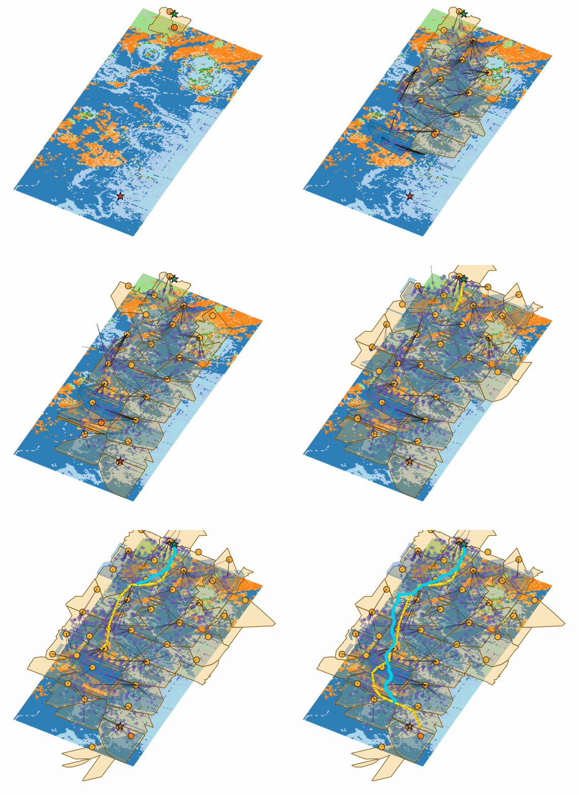
HOPHY planned path on Wharton
Wharton · 9 km²Coarse-to-fine search selects and refines a feasible route corridor.
HOPHY planned path on Humphrey
Humphrey · 50 km²The hierarchy prunes irrelevant terrain before committing to a route.
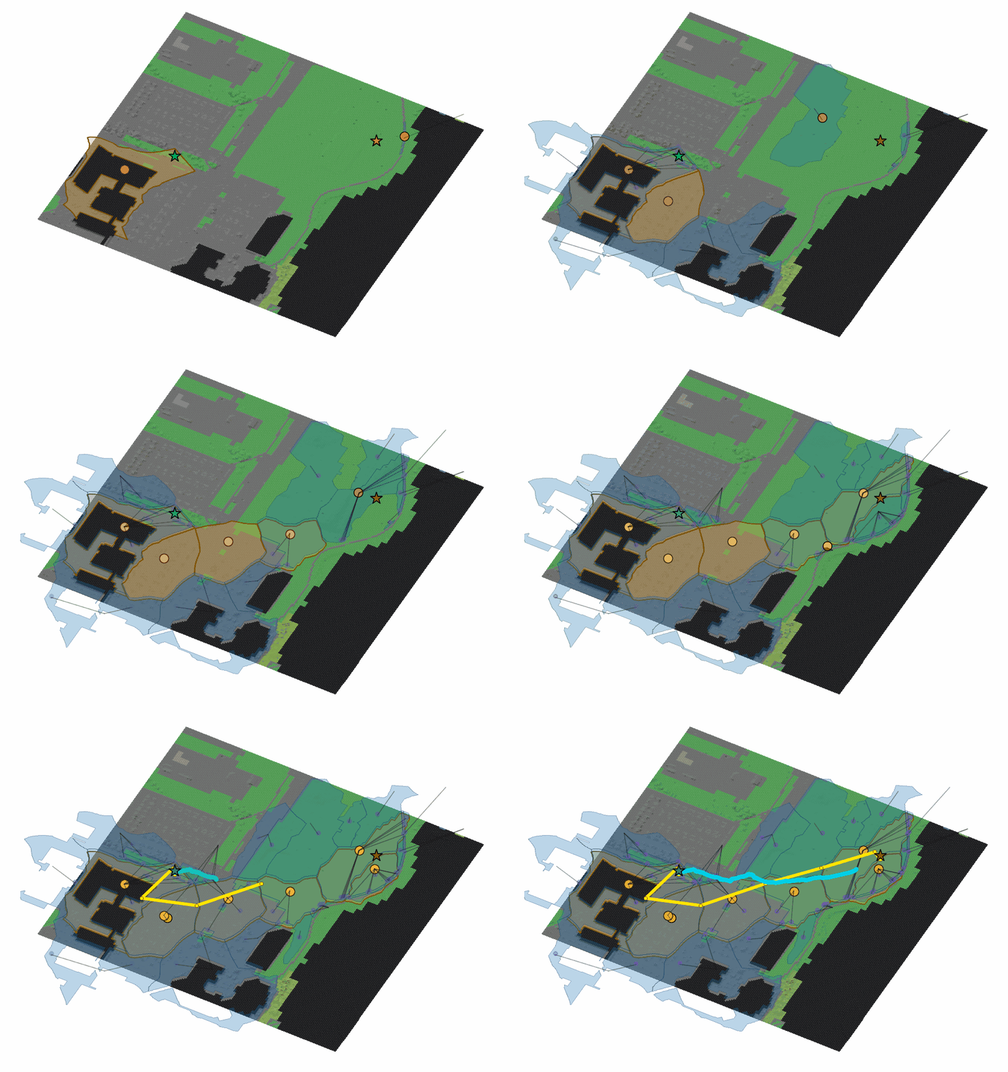
HOPHY planned path on UB Campus
UB CampusThe same query process transfers to a compact deployment map.

Path Planning and Replanning

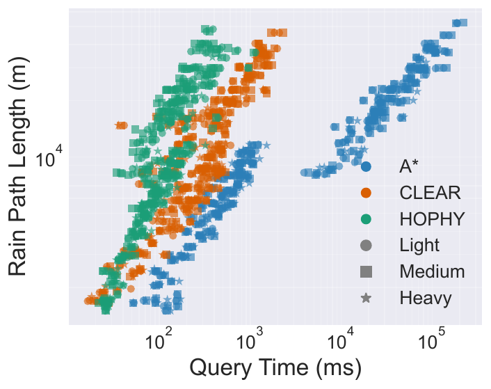
On Wharton, Humphrey, and Rainier, the current direct implementation succeeds on all 270 static benchmark queries and records a 0.00% median cost difference from pixel A*. Under light rain, medium rain, and localized blockage, it succeeds on all 810 replanning queries while keeping the median cost and length differences at 0.00%.

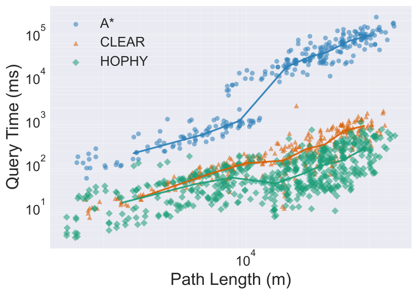
HOPHY query time and path-quality results
Query time as route length increases across the three terrain maps.
HOPHY rain and blockage replanning results
Context-sensitive replanning under weather changes and localized blockage.

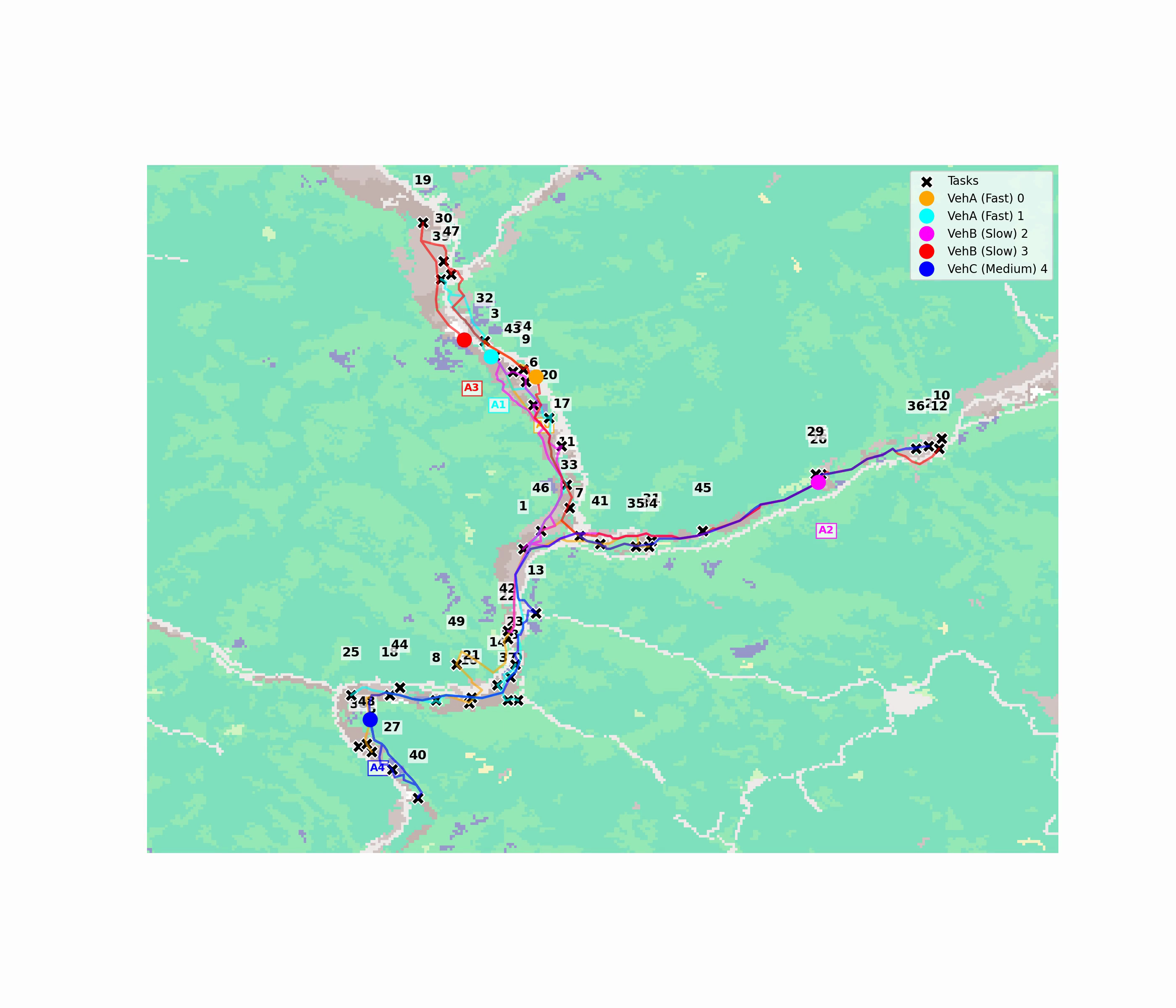
Multi-Agent Mission Planning

HOPHY can serve as the repeated path-cost oracle inside a larger task-allocation loop. This lets heterogeneous teams compare many candidate assignments and routes without repeating dense pixel-level search for every task pair.

HOPHY multi-agent mission-planning result